The jewel in Iceland’s tourism crown, the Golden Circle encapsulates three major destinations, all conveniently located close by to Reykjavík and easily covered by a day trip at any time of the year.
During the summer, a morning spent exploring the wonders of continental drift at Þingvellir can be followed by another hour’s drive to marvel at the power of nature on show at Geysir and Gullfoss, which are within just a few miles of each other.
A few hours of capturing amazing images and memories later, there’s the choice of a simple return along Route 36 and an evening out in Reykjavík, or perhaps an extended trip by heading down Route 35 to Selfoss, taking in Skálholt or perhaps the dramatic red earth volcanic crater at Kerið.
With longer daylight hours to play with, perhaps a further diversion to Eyrarbakki or Stokkseyri might also be included in a Golden Circle loop.
In winter months, a more focused trip is advisable, given the reduced daylight and more testing driving conditions, but it’s still feasible to see all three highlights of the Golden Circle.
The route is easy to follow – leaving Reykjavík, pick up Route 36 which will include plenty of signposts to Þingvellir.
There are two viewing stops along the route before the visitor centre car park itself, which are safer to use than pulling over on the road itself, especially at busy times.
Þingvellir National Park
About 40km from Reykjavík, Þingvellir is the first stop and the one that should have the most time devoted to it.
The car park is pay and display (500ISK) and there is a 100ISK fee for the toilet block too. There are free portaloos down in the rift itself, but it could be an hour’s walk before these are reached.
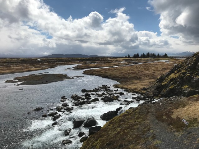
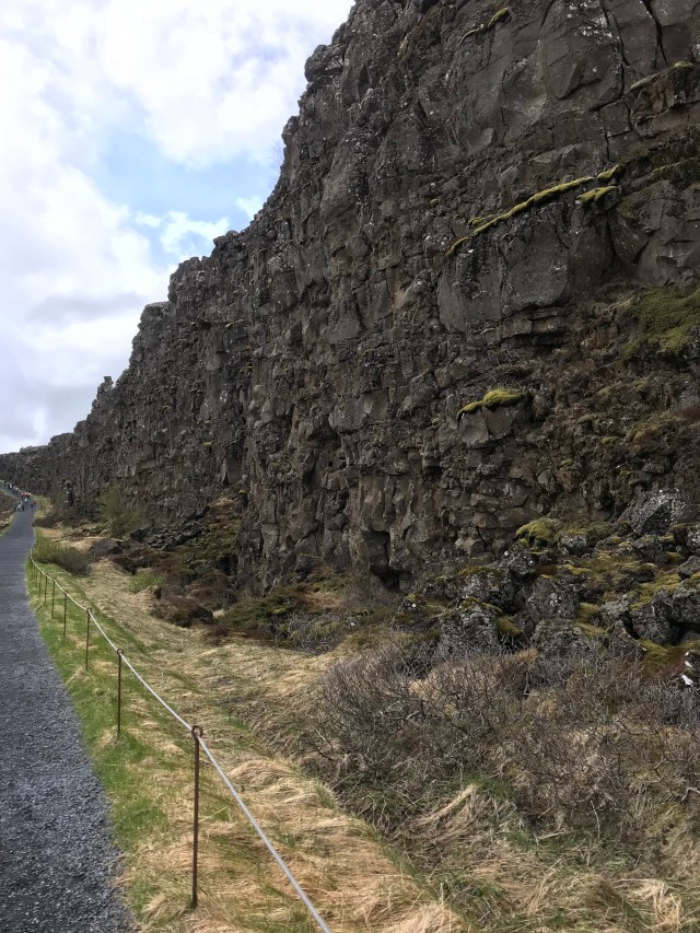
Þingvellir is a visual spectacle barely matched elsewhere on Earth.
Continental plates are tearing apart in front of your very eyes, albeit at the speed of a few millimetres a year.
Geologically fascinating, it’s also hugely significant in the cultural and historical life of Iceland, site of the first recognised Parliament, established by the Vikings in 930AD.
Throughout the ages, Þingvellir has been home to national festivals, law making sessions and other major events, including the Declaration of Independence in 1944. It was made a UNESCO World Heritage site in 2004.
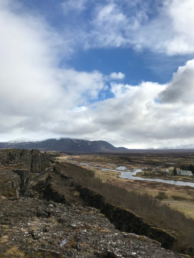
A viewing platform offers stunning vistas across the split in the Earth’s crust, with the division between the American and Eurasian tectonic plates being plain to see.
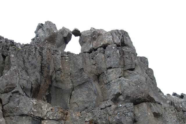
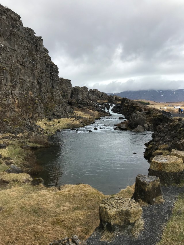
Further down in the rift itself, it’s possible to visit the “Law Rock”, where significant rulings were declared to the backdrop of dizzying cliffs and bizarre rock formations.
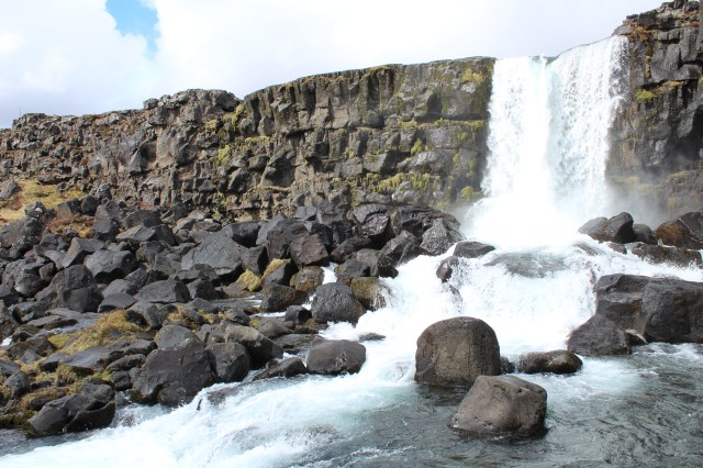
A little further along cascade the waters of Öxarárfoss, which feeds into Þingvallavatn, a gigantic glacial lake, containing the run off from Langjökull.
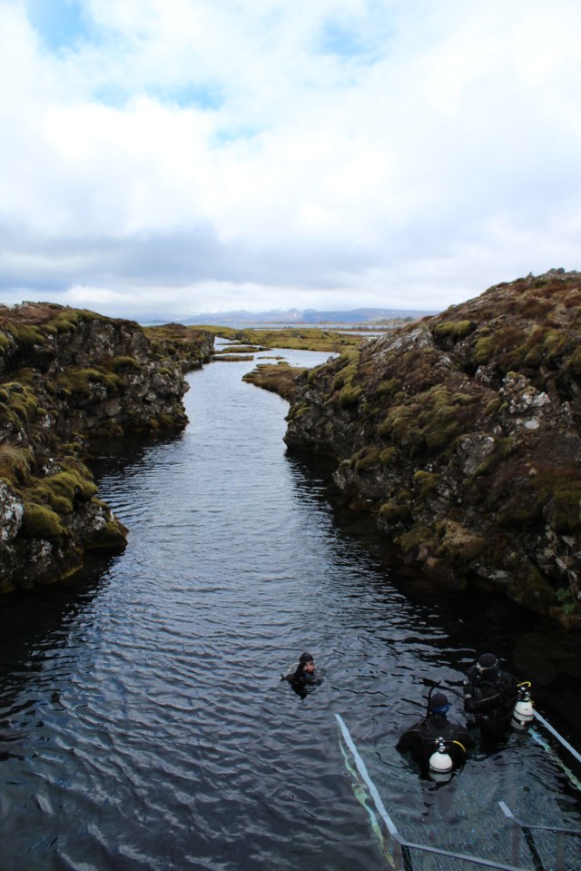
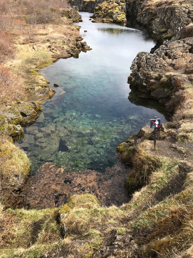
For those with appropriate equipment to dive in freezing waters, the fissure at Silfra offers a chance to snorkel in crystal clear conditions.
Historically, these waters often had darker purposes, with miscreants being punished in the nearby Drekkingarhylur drowning pool.
Nowadays, coins are the only things thrown into the waters, although this is discouraged.
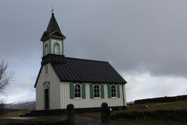
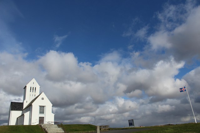
Þingvellir is also the location for a pretty church and the Prime Minister’s summer residence.
A full circuit of Þingvellir will offer another view of the tectonic rift.

All along the pathway, the rocks rise up in dramatic formations.
Onward to Geysir, take Route 365 to Laugarvatn, where there is a decent shop for supplies before heading to Geysir on Route 37.
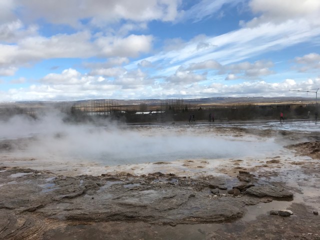
Geysir
The place where the name for all similar geographical water features originated, Geysir itself is mostly still and silent now, but nearby Strokkur is reliably faithful, searing into the sky every few minutes.
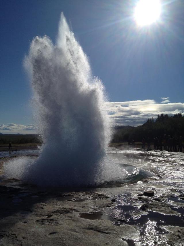
It’s possible to get quite close to Strokkur, but it’s wise to check on the prevailing wind before settling in for the next eruption, to avoid a possible soaking.
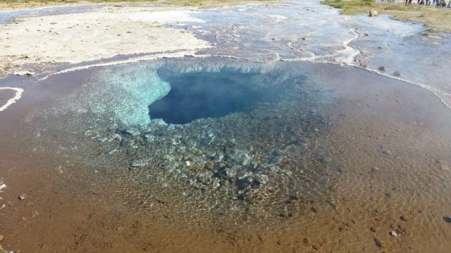
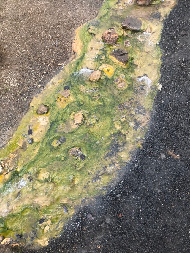
Part of the Haukadalur geothermal region, steam and hot pots bubble and sputter all around.
Rivulets of superheated water trickle all around, leaving intriguing colourful residues behind.
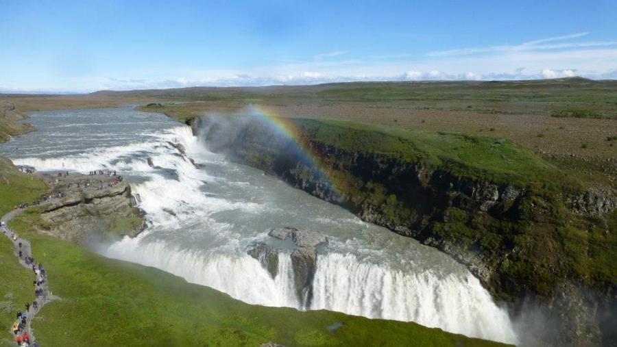
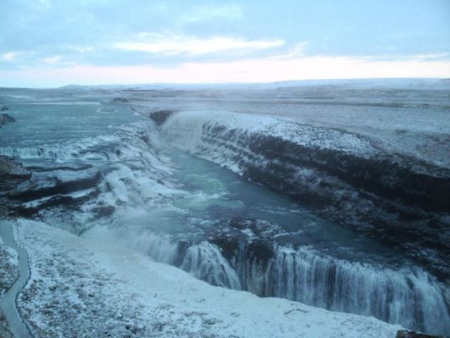
The last of the Golden Circle trio is the mighty waterfall at Gullfoss, a few miles further along Route 35, essentially at the end of the road.
Gullfoss
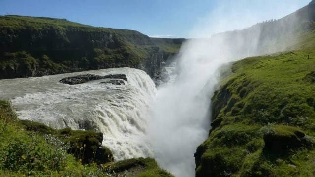
A double drop waterfall with a cascade of more than 30 metres and lots of spray as millions of gallons of water crash into a narrow ravine, Gullfoss is a marvel at any time of the year.
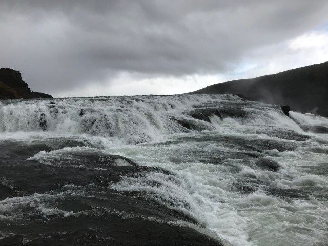
Triggering countless rainbows on sunny days, equally staggering when partly frozen in winter, it narrowly survived conversion into a hydroelectric power plant a few decades ago, but is now a protected site and, like Geysir, is free to enter and to park.
Returning back towards Reykjavík, there is an alternative to simply doubling back on Route 36, by instead taking Route 35 towards Reykholt and onto Skálholt, one of Iceland’s most important religious centres.
Further along and a few kilometres off Route 35 lies Sólheimar Eco Village, where alternative solutions to modern life are practised.

Not much further along, before reaching Selfoss, lies the huge Kerið volcanic crater, with its dramatic red earthen rubble strewn all about.
Flúðir is also on this route, where the Secret Lagoon can be found.
Selfoss itself is largely unremarkable, apart from its usefulness as a rest and refuelling stop.
From here, the return to Reykjavík should take no more than 45 minutes.
Potential diversions include the two little seaside villages of Eyrarbakki and Stokkseyri, or perhaps the Floi Nature Reserve.
Route 39 then leads back to Route 1 and Reykjavík.
